domingo, 10 de febrero de 2013


Timeline of Tehuacan
8500 BC
Choco-popolocas tribe coming from Coapan, settled in what was known for years as Tehuacan Viejo

5000 BC
                             Wild pod corn is cultivated in the Tehuacan valley in Mexico. 

4800 BC
 Archaeological evidence from Tehuacan in south central Mexico shows that maize, squash, chili peppers, avocados, and amaranth were cultivated

1500
    A conqueror Nonoalca of name Xelhua, was positioned of Tehuacan

                                                                             1660

                                     Indians bought the royal crown title “ciudad de indios”

1812
               The city at the time of the insurgents served as a strategic point for location               giving asylum to the troops of Morelos

1862
 French army invading Mexican territory, staying in Tehuacan.

1884
 Tehuacan renamed " Tehuacán de Juan Crisóstomo Bonilla"

1991
  Due to its famous waters springs the city will become an international tourist center filling of large luxury hotels at the time.

2000
Tehuacan becomes an industrial city.


History of Tehuacan

Tehuacán was part of the royal road that communicated to the port of Veracruz to Tenochtitlan. Historical past dates back to 8500 BC. The choco-popolocas tribe from Coapan, was established in Tehuacán Viejo.
The history of the region dates back to ancient years before it was a stretch of sea currently leaves its trail in San Juan Raya with an immense amount of fossil, dinosaur footprints; in the city of Tehuacán there streets with ridges formed limestone named “Tecuate” that were once sea corals. During pre-Columbian times is noteworthy that the Tehuacan Valley was crib corn and avocado. The early civilizations were popolocas who built the city of the sun "Tehuacan old", unfortunately not much is known of this archaeological zone, even have been found vases and ceramic.
The city at the time of the insurgents served as a strategic point for location giving asylum to the troops of Morelos.
In the early twentieth century due to its famous waters springs the city will become an international tourist center filling of large luxury hotels at the time.
Tehuacan is also known for its fairs, the best known is the the fair of pomegranates, that's why Tehuacan is known as the city of pomegranates. In which it presented a bit of what is Tehuacan, with a mixture of customs and traditions originating indigenous and Spanish architecture, culture and cuisine.
Currently is a quiet city, where just 5 years ago are having industrial growth.


Shield of Tehuacan

The Shield of Tehuacán is made up of four quarters:
In the first quarter there is a black eagle on the nopal with two arrows in its right claw and another crossed by its legs, on the left side of the quarter are three maize with spikes of gold which the Indians call "Miahuatl", in a blue field.
In the second quarter it shows a Black Eagle in white with a golden beak putting one leg on a teponaxtle and the other lifting two clasped arrows. At the right side of the eagle an ayacaxtle or sonaja is playing an instrument and dancing with the Indians. Just below is a drum, on the left side are two teponaxcle and below sits a Quetzal feather.
In the third quarter there is a bush with a red flower on its outspread branches; in the native language the flower is called a "tlaxochitl". Below the tree is a bird digging up a flower, the tree is called a Mezquite. On the right side is a castle on a hill and near it there are white and colored stones, below the castle is a cave.
In the fourth quarter there is a decapitated head which is held up by a hand that is reaching out from the right side and is holding the head up by its hair, the left hand is also in the picture and is grasping an arc. In the midst of the four quarters the head of Chimalpopoca and as Cimera, the Virgin of the Conception.

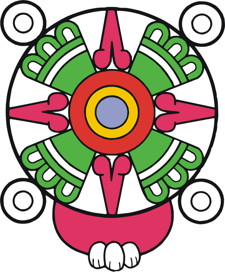
Glyph of Tehuacan

The glyph of Tehuacan It´s based on the work of Felipe Franco of the year 1946 “Indonimia Geográfica del Estado de Puebla” same as inferred from the word Teohuacan, that is, instead of gods.
The glyph is interpreted so: At the bottom is a gum with teeth, which means place. The disc is a solar symbol. This is why to Tehuacan is known as a place of gods.

Map of Tehuacan


Map of Puebla


Map Of Mexico